Australian rock art: 3D modelling for research, conservation & education
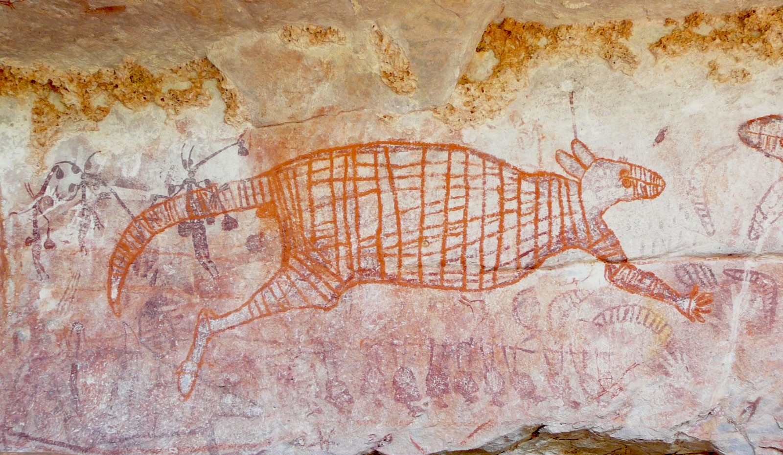
This rock art is found in the Balanggarra Indigenous Protected Area, in the northern Kimberley region of WA. Image credit: Balanggarra Aboriginal Corporation and UWA Centre for Rock Art research + Management
Australia's rock art represents a unique cultural heritage spanning tens of thousands of years. However, many remote sites are difficult to access, limiting opportunities for communities, educators and researchers to engage with this significant cultural asset.
This project advances digital conservation of Australian rock art through two key initiatives:
- Establishing a secure, accessible online repository house culturally significant 3D models of rock art sites
- Developing a user-friendly online photogrammetry tool to support our Indigenous collaborators, local rangers and cultural heritage workers in remote communities.
The research team has completed digital documentation and Virtual Reality (VR) work in the Kimberley region of Western Australia and is commencing similar work in Arnhem Land in the Northern Territory. This work has generated a substantial library of high-resolution, geolocated 3D models and immersive 360-degree videos of rock art shelters and surrounding landscapes. These digital assets are designed for use on desktop and VR platforms, enabling applications in heritage documentation, conservation planning, immersive education and public outreach.
Our project prioritises capacity building by supporting Indigenous partners and local students to independently capture imagery using drones and cameras, and to process, manage, and curate 3D models. The design and visualisation of user-friendly digital tools and infrastructure will deliver genuine benefit to communities by increasing access to remote heritage sites, supporting education and conservation, and fostering community-led digital capability and cultural stewardship.
MDAP's expertise is critical to this collaboration. They will develop digital infrastructure including cloud computing and secure repository creation. MDAP will contribute advanced data visualisation for 3D model creation and annotation, and potentially machine learning for analysing colour, motifs and context. They will establish structured data governance ensuring ethical, accurate and accessible management of culturally significant spatial imagery, and implement long-term data preservation safeguarding raw and processed outputs with metadata for future use.
The resulting digital infrastructure will serve as a lasting resource for communities, educators, and researchers, advancing the field of digital conservation and supporting long-term cultural resilience. The tools and methodologies developed will be scalable and applicable to heritage sites across Australia and internationally.