L8. Map the biodiversity you have, could have, and where the key gaps are
Enhancing biodiversity conservation in urban areas through mapping and analysis
Urban areas play an important role for native species conservation, and council boundaries may be host to significant remnant biodiversity. Surveying and mapping native species and ecosystems provides a valuable knowledge base to enable the protection, expansion and restoration of biodiversity in your local area.
There are a range of mapping techniques that can be used to assess different elements of biodiversity at a landscape level. These methods range from simply visualizing all vegetation, water and other resources, to quantitatively assessing the performance of different areas for specific species. Some ecological metrics can easily be calculated for a government area, allowing comparison of different planning decisions. For example, ecological connectivity analysis quantifies how easily different species can move through the built environment, identifying key habitat patches for protection and areas that could act as future corridors.
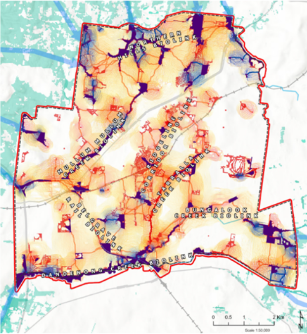
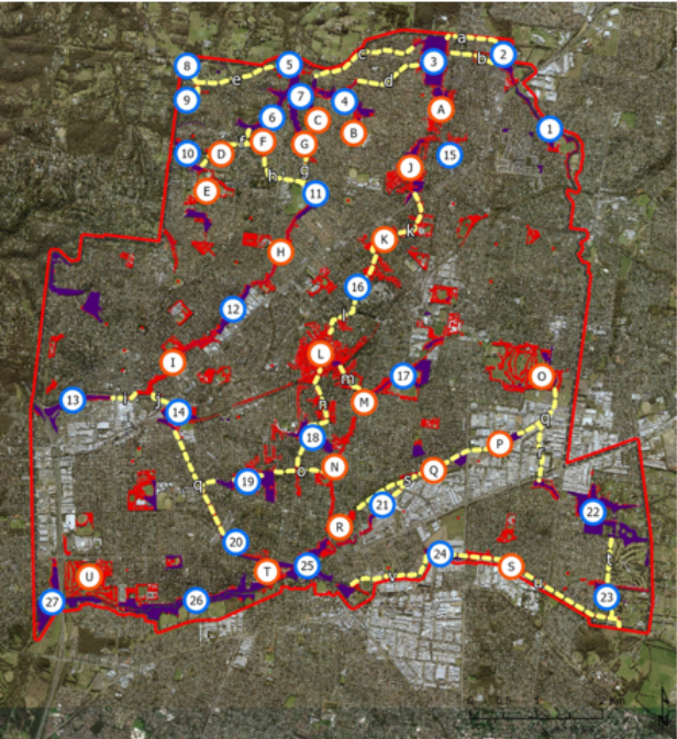
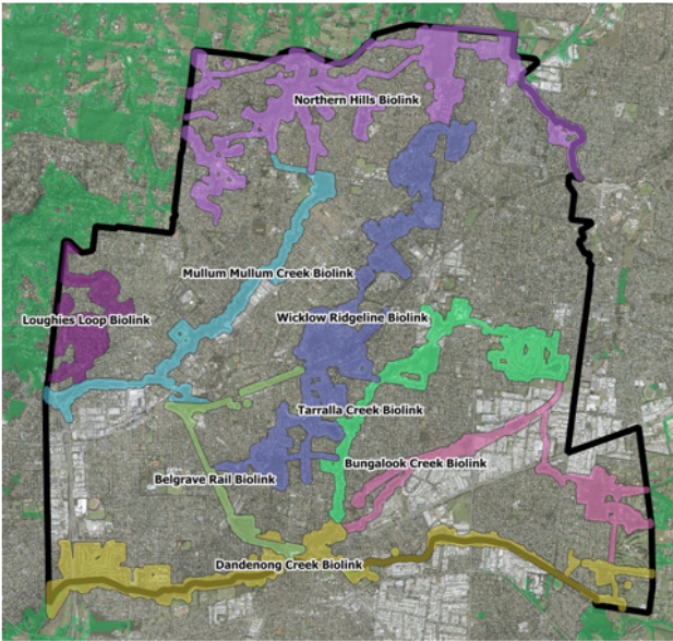
Case Habitat Connectivity Plan (Maroondah City Council)

Case Study Biodiversity Baseline Data Project, University of Melbourne
The Biodiversity Baseline Data Project aims to quantify biodiversity across the University of Melbourne’s seven campuses. The project uses seven preliminary biodiversity metrics to measure biodiversity. These metrics include plantable area, number of areas of ecological significance, number of understorey plant species, number of trees and tree species, tree canopy cover and number of fauna and fungi species. Data collected through the project establishes biodiversity baselines for the University to adhere to and improve upon. The project also strategically identifies priority areas for revegetation, informs species selection for campus plantings and provides opportunities for student to contribute towards the University’s sustainability commitments.
Find out more information here.
Resource Improving connectivity for biodiversity across the City of Melbourne: A framework for evaluating and planning management actions, The Clean Air and Urban Landscapes Hub
This resource provides a report and methodological framework to measure habitat connectivity for a series of key animal groups across an urban landscape.
Find out more information here.